Scattered showers today, but summerlike warmth returns mid-week

A weak cold front has moved into northwest Oklahoma, accompanied by an upper-level disturbance positioned to the north that has helped pull some Pacific moisture into Oklahoma. As the front approaches, scattered showers and a few isolated thunderstorms are expected to develop near the boundary. Severe weather is not anticipated.
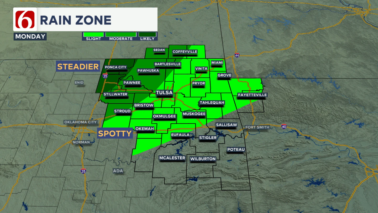
For most areas that do see rain, the amounts will be light. The steadier rains will be focused just northwest of Tulsa, with some spottier showers for the Tulsa metro. And some locations will remain dry, particularly in southeastern Oklahoma.
What about temps today?
This patchy rain and cloud cover will help keep far northeast Oklahoma cooler compared to the southern parts of the state.
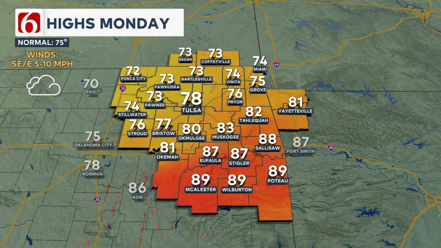
Monday afternoon highs will range from the lower 70s to lower 80s across northern Oklahoma depending on rain coverage, but still climbing to near 90 in southeastern Oklahoma.
What’s ahead for the middle of the week?
From Tuesday through Thursday, a strong upper ridge will build over the Southern Plains, keeping major storm systems at bay and ushering in more summerlike weather.
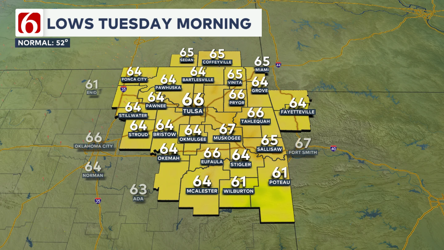
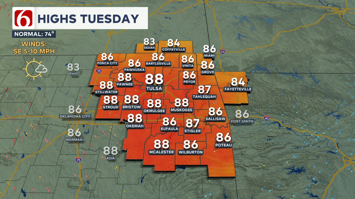
Morning lows on Tuesday will start in the mid-60s, with afternoon highs generally in the mid to upper 80s. Expect mostly sunny skies and light southeast winds.
When will our next storm chances return?
Heading into Friday and the weekend, the upper-air pattern becomes more amplified, and the main belt of westerlies aloft will begin shifting southward. This setup should bring a stronger cold front and renewed storm chances.
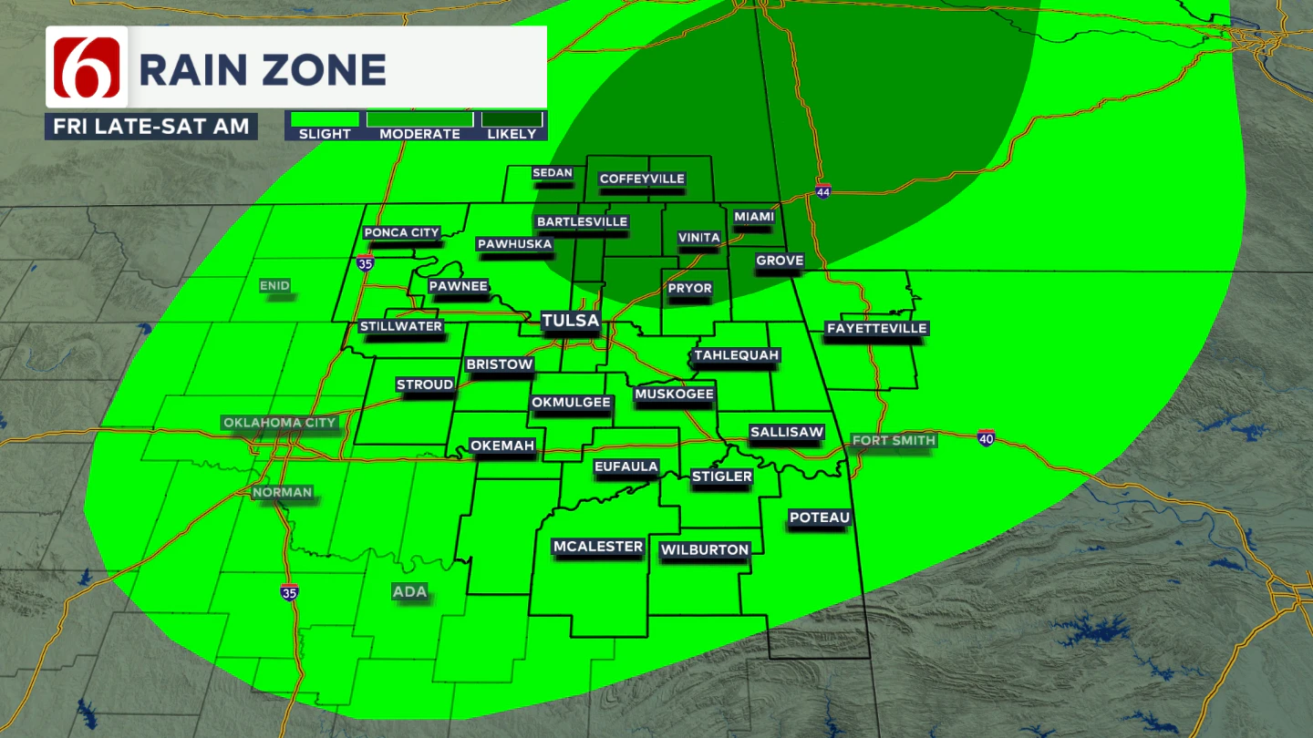
As of now, the best chance for rain arrives late Friday evening into early Saturday morning. A few additional storm chances will be possible Saturday afternoon and evening, but mostly across far eastern Oklahoma.
What kind of weekend temperatures can we expect?
Weekend temperatures will start in the upper 60s and rise to the mid-80s by Saturday afternoon.
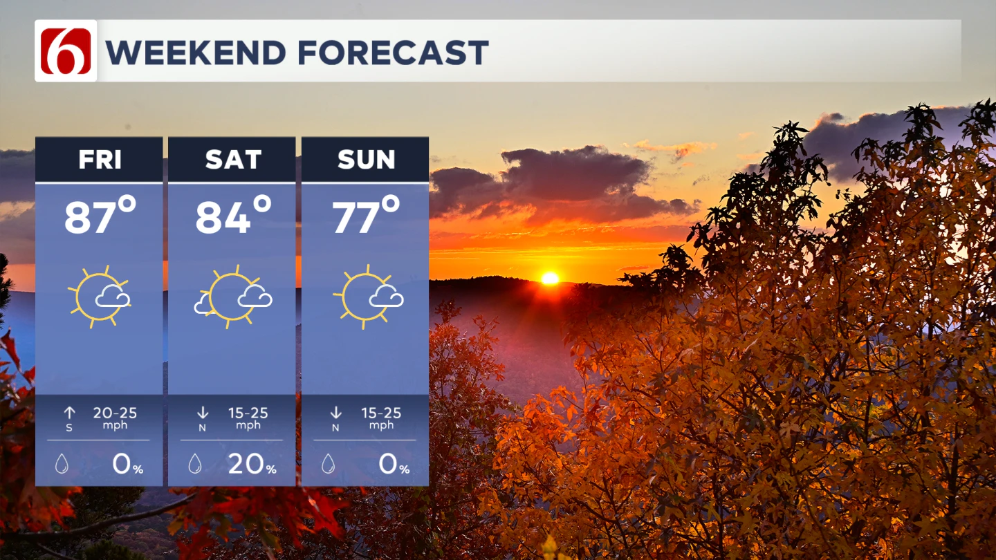
The front is expected to clear the region early Sunday, allowing for a return to more seasonal, fall-like conditions with highs in the 70s.
Any Severe Weather In the Near Future?
In the short term, we are not expecting severe weather. Just a reminder that fall is a transitional season, and it often brings the potential for strong to severe storms across Oklahoma. The front that is expected for part of the weekend will have a chance to produce some severe weather threats. The early outlook Saturday is highlighting part of eastern Oklahoma and Arkansas for a risk of severe storms.
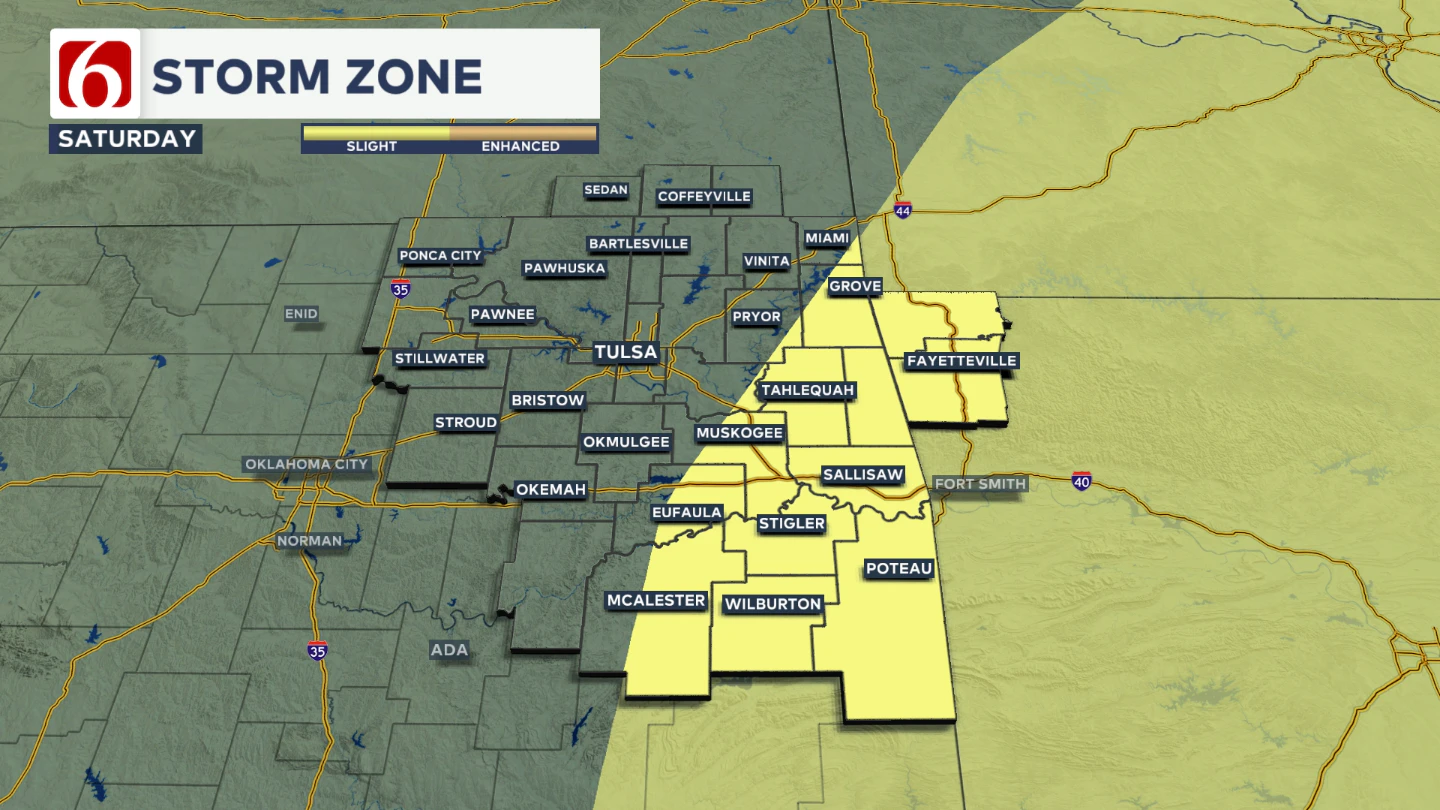
This zone may shift a little as we draw closer to the Friday and Saturday period.
Fall is considered our second peak for severe weather, even though severe storms can occur any time of year when conditions line up. Over the next few weeks, expect an uptick in cold fronts and storm chances as warm, moist air continues to clash with the cooler air of the advancing season.
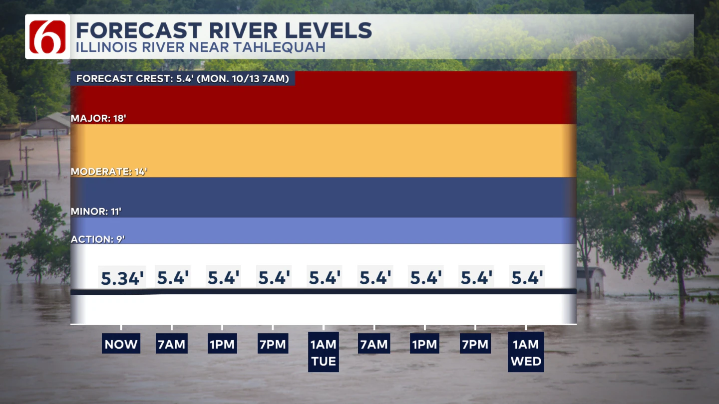
The Illinois River near Tahlequah
The Morning Weather Podcast:
The daily morning weather podcast briefing will remain on hold indefinitely due to ongoing internal workflow issues.
We're working to resolve these challenges as soon as possible and appreciate your patience. We apologize for the inconvenience and hope to be back soon. Thank you for your understanding.
Need-to-know severe Oklahoma weather prep:
🔗Severe weather safety: what you need to know to prepare
🔗Tornado Watch vs. Tornado Warning: what they mean and what to do
🔗Severe weather safety: what to do before, during, and after a storm
🔗Why registering your storm shelter in Oklahoma could save your life
🔗Floodwater kills more Oklahomans than tornadoes in the last decade, here's why
🔗'Turn around, don't drown': Flood safety tips for Oklahomans
🔗5 things to know: How Oklahomans can get federal money to install storm shelters
🔗Breaking down the SoonerSafe Rebate Program: Do I qualify for a storm shelter?
Watch us on YouTube
Follow NewsOn6 on X/Twitter for automated severe weather alert posts: @NewsOn6
Emergency Info: Outages Across Oklahoma:
Northeast Oklahoma has various power companies and electric cooperatives, many of which have overlapping areas of coverage. Below is a link to various outage maps.
- PSO Outage Map
- OG&E Outage Map
- VVEC Outage Map
- Indian Electric Cooperative (IEC) Outage Map
- Oklahoma Association of Electric Cooperatives Outage Map — (Note: Several Smaller Co-ops Included)